Wondering what it’s like to walk the Kokoda Track? Here’s my experience of hiking this challenging but incredible trail.
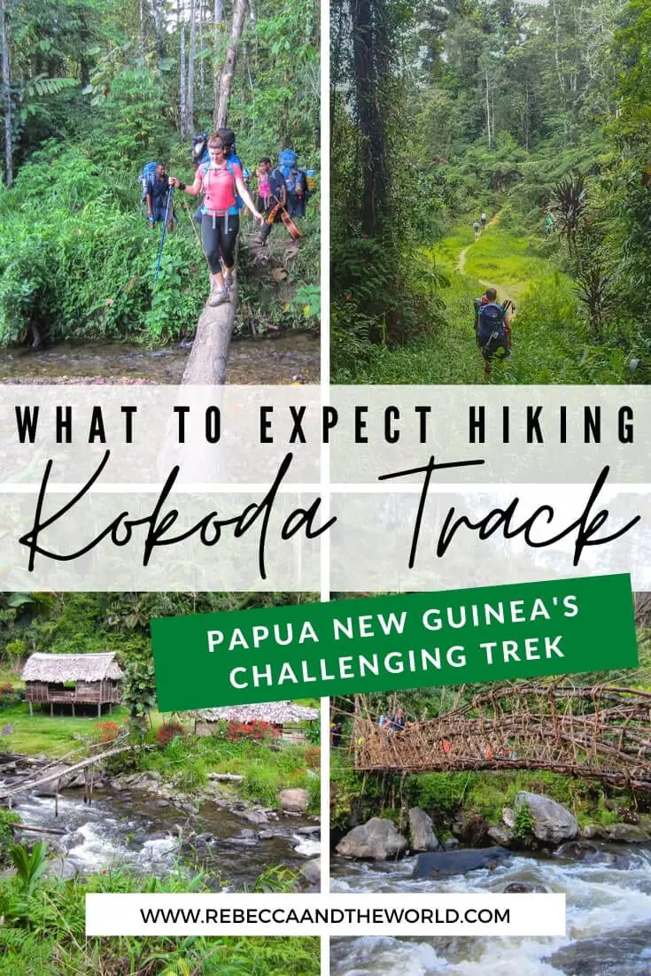
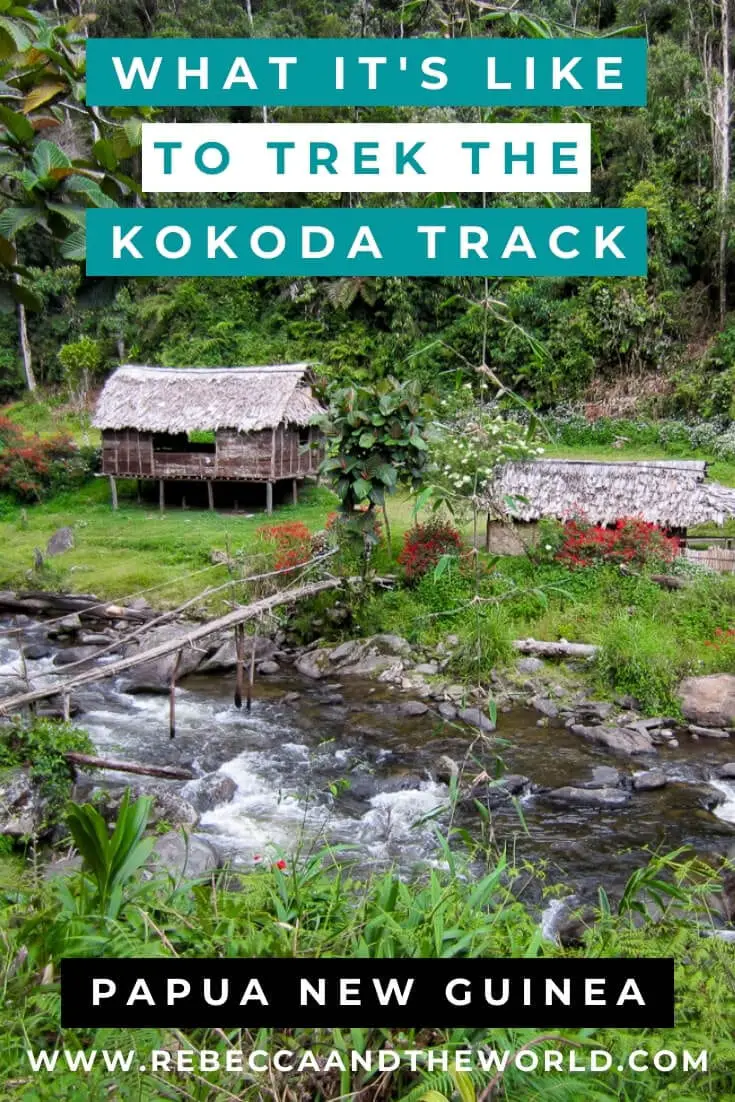
Hiking the Kokoda Track (also known as the Kokoda Trail) is one of the most challenging and sobering things I have ever done. Located in Papua New Guinea, this 96-kilometre track is not for the faint of heart.
I lived in Papua New Guinea for almost four years, and I knew when I moved there that I wanted to trek Kokoda.
This post is a day-by-day diary entry of what we went through – and what you can expect if you trek the Kokoda Track.
If you’re after practical information such as how to get permits to trek Kokoda, what to pack, what you’ll eat during the trek or which trekking company to use, then read my Kokoda Track packing list and tips blog post.
Read on to learn what it’s like to trek Kokoda!
Papua New Guinea recently launched a Digital Arrival Card (DAC), which you’ll need to complete online up to 72 hours before arriving in the country. This online card replaces the paper-based incoming arrival card. It’s free – complete it online at the Papua New Guinea Immigration and Citizenship Services Authority.
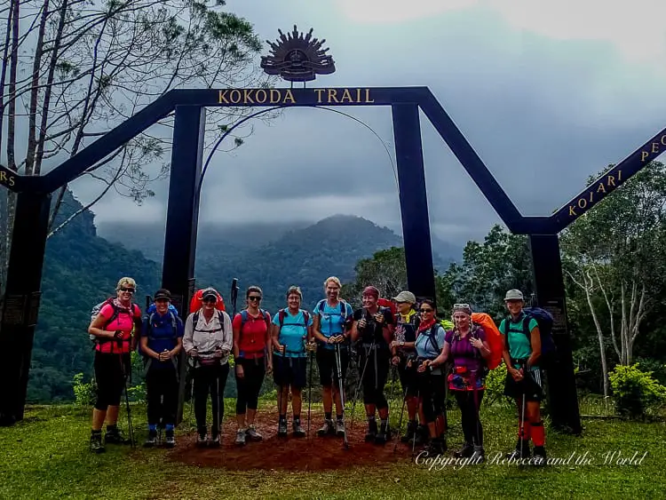
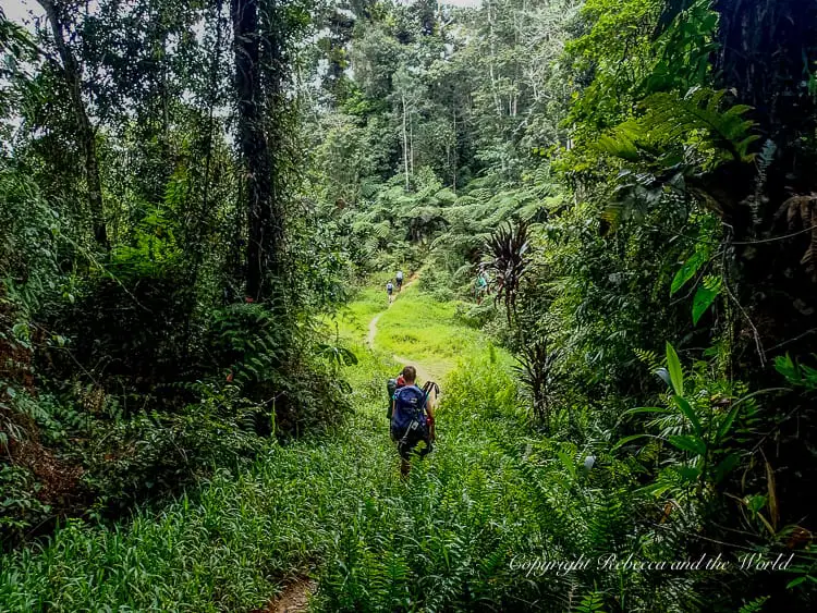
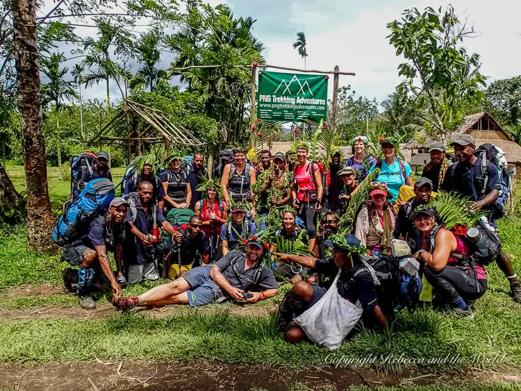
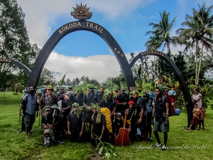
Day one: Owers Corner to Ioribaiwa Village
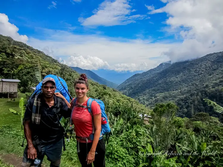
“Ready?” yells Silas, the head porter.
There is a resounding cheer from the rest of the 24 porters.
“Onwards and upwards! Onwards and downwards!” he roars.
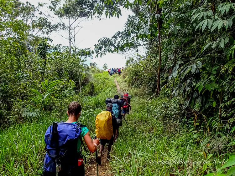
And off we go. There’s no turning back from here. All the training that we’ve done was for a reason – and this is it. We’re trekking the Kokoda Track.
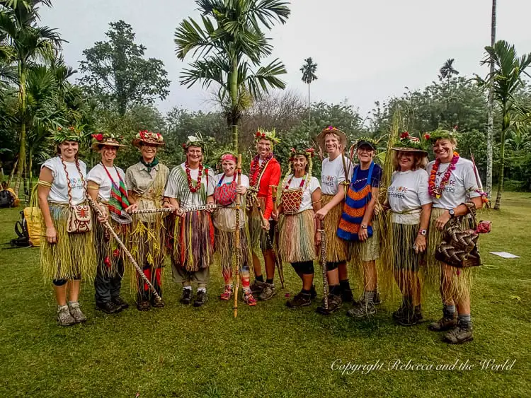
As a group, we pose for photos under the entrance archway. Then one by one, we file down the wooden steps that mark the start of our nine-day journey through the jungle of Papua New Guinea.
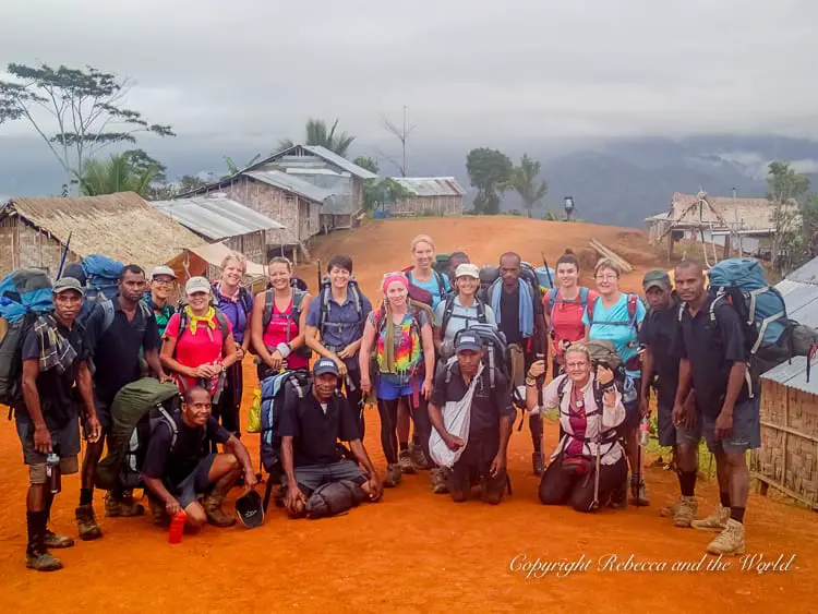
The night before, at our briefing, we asked all the questions we could think of. Our tour leader, Wayne, had looked slightly concerned at what lay before him, his first tour leading a group by himself, and a group of only women at that.
As we go down the stairs, there’s a sense of excitement among the group. We’re really doing this!
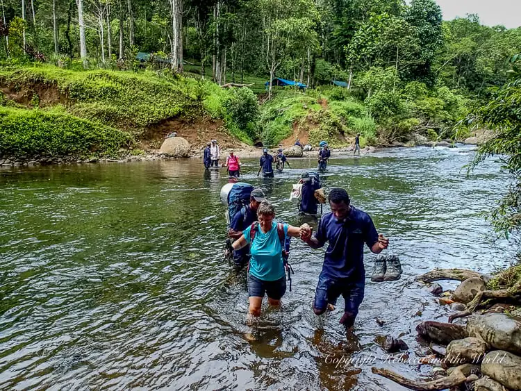
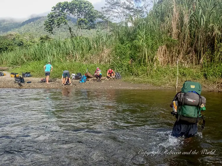
We chat and laugh, taking off our boots to wade across the Goldie River, the swirling waters almost reaching our waists. The water is nice, cooling, but it’s not long before the heat and our own exertion dries us off.
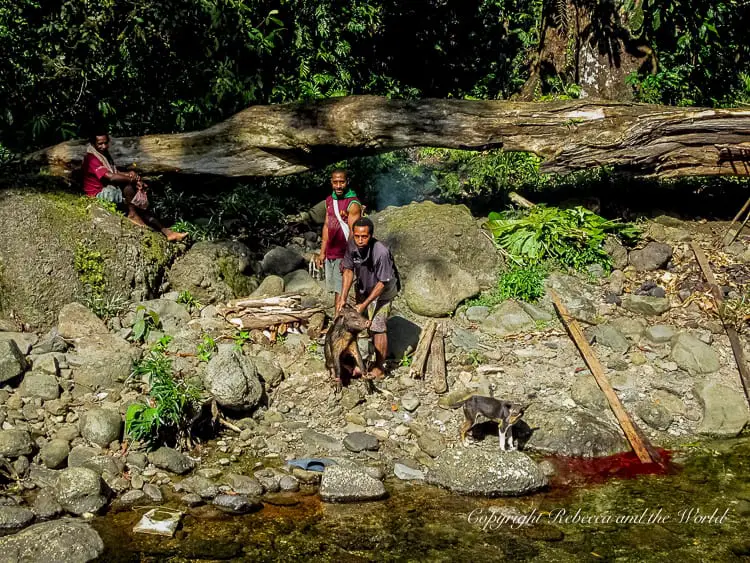
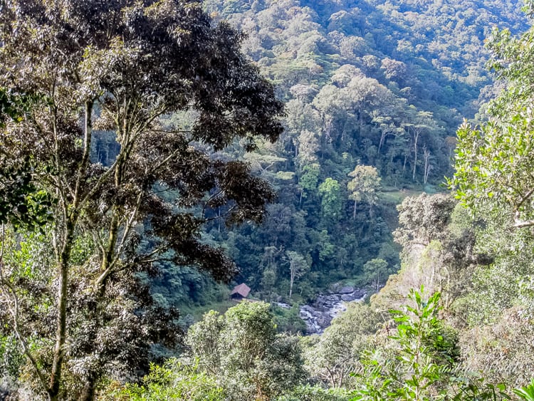
At Goodwater we stop for morning tea, watching as a freshly killed pig is paraded by the villagers and then butchered by the side of the river. Red blood pools in the brown water, and the village dogs watch expectantly.
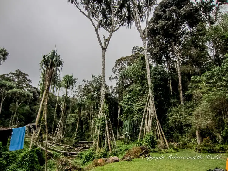
The talking tapers off as we start to make our way up Imita Ridge, a steep climb that will take us up to 850 metres above sea level. I’ve done this before, on a practice walk, so I know what to expect, but it’s still tough. As we trudge our way up the Golden Stairs, our thighs burning, I see a patch of clear up above. Is this the top? Or a false peak?
With the sounds of “Oro, oro, oro” (“welcome” in Tok Ples) echoing above me, I know we’ve reached the top. Exhausted but energised by our achievement, we snack some more, before we begin the downward climb.
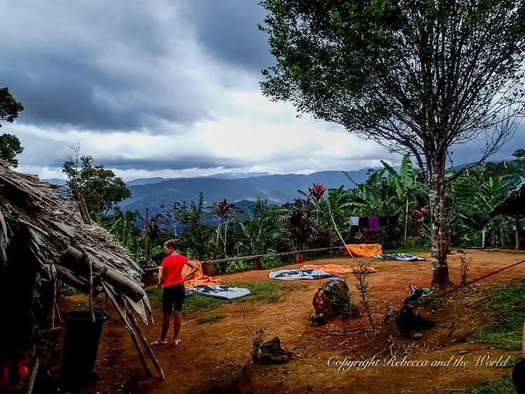
We pass through Ua-Ule, which is supposed to be our camp for the night. We’re making good progress so Wayne decides that we will push on for another few hours and make camp at Ioribaiwa Village.
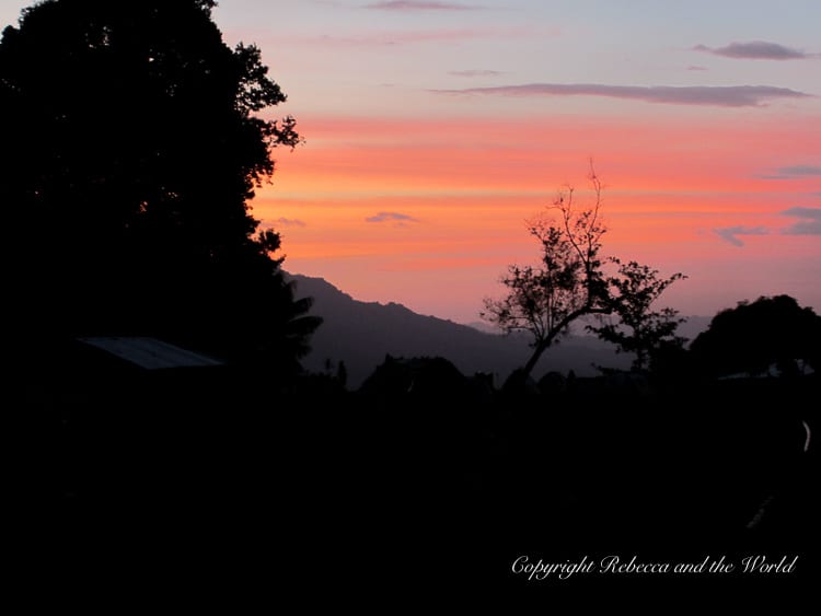
As we reach Ioribaiwa, the sun is slowly sinking, creating a spectacular kaleidoscope of colours. From our vantage point on the edge of hill, we have a fantastic view of the changing landscape, and as the sky darkens we chat with another group of trekkers, heading in the opposite direction. It’s the last night of their Kokoda trek, and there’s a sense of both relief and sadness as the end approaches.
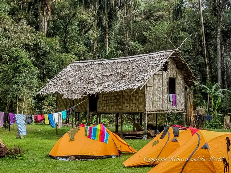
We set up our tents and laugh with the village kids as they play soccer with a ball that’s seen better days. The “shower” is a trickle from an overhead tap, a blue tarp surrounding only three sides.
Settling into my sleeping bag that night, the first night, I think about what lays ahead on the Kokoda trek, what challenges we will face. But, having made it through the first day, I know that whatever comes, I will face it head on.
READ NEXT: The ultimate Kokoda Track packing list
Day two: Ioribaiwa Village to Nauro
We wake at 5am on day two, the first full day of our Kokoda trek. Despite the new environment, I’ve slept well, the only thing waking me from time to time the rustle of other trekkers in their tents and the incessant crowing of the village roosters at all hours of the night.
We set off at 6.30am, eager to begin the day’s walk. Our first challenge is getting up to the top of Ioribaiwa Ridge, 850 metres high.
Here, we stop and look at some trenches that were built and used by the Japanese during World War Two. We read a poem and reflect on what our grandfathers had to do so many decades ago to protect Australia. Here, the realities of what they went through become clear – although it’s still hard to imagine that fighting in this thick jungle was actually possible.
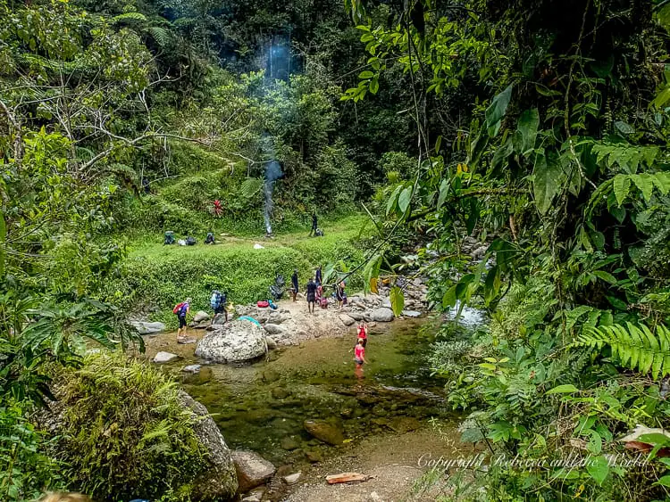
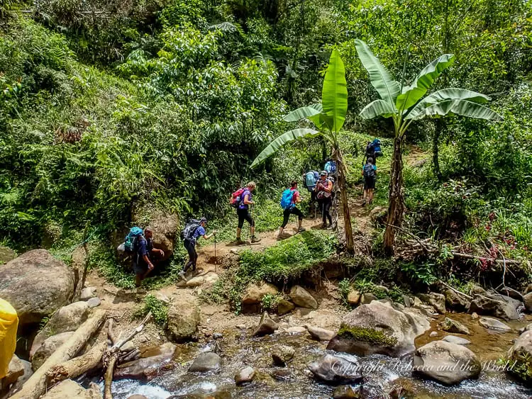
We continue on, a gentle climb down to Ofi Creek, where we have morning tea beside the icy water, only a few of us brave enough to take a dip. It’s then a tough climb up to the Maguli Range.
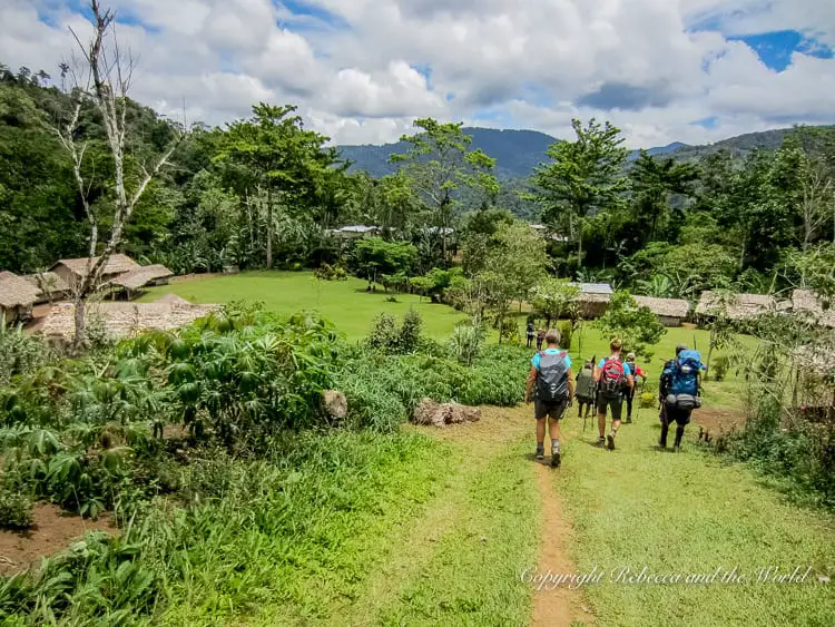
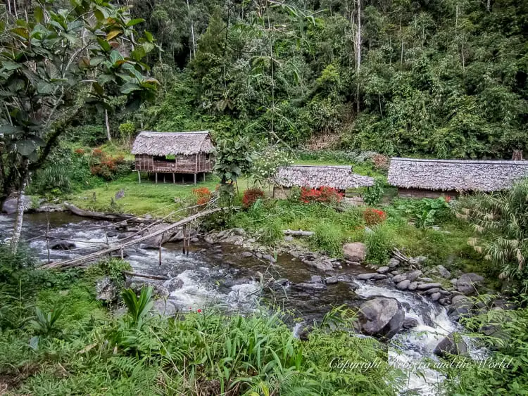
When we arrive at our camp for the evening, in the village of Nauro, we’re greeted by beautiful decorations in our eating hut, with ferns and vibrant red flowers placed around the doorways and table. We’re here by lunchtime, a short day of walking behind us, and rest ahead of us.
Later that evening we’re treated to another brilliant sunset, our campsite overlooking lush jungle – and views of the mountains and hills that we’re yet to conquer.
Day three: Nauro to Manari
Our third day and we’re all feeling great. Another group camped at the same camp as us last night and we’re keen to get moving before they do.
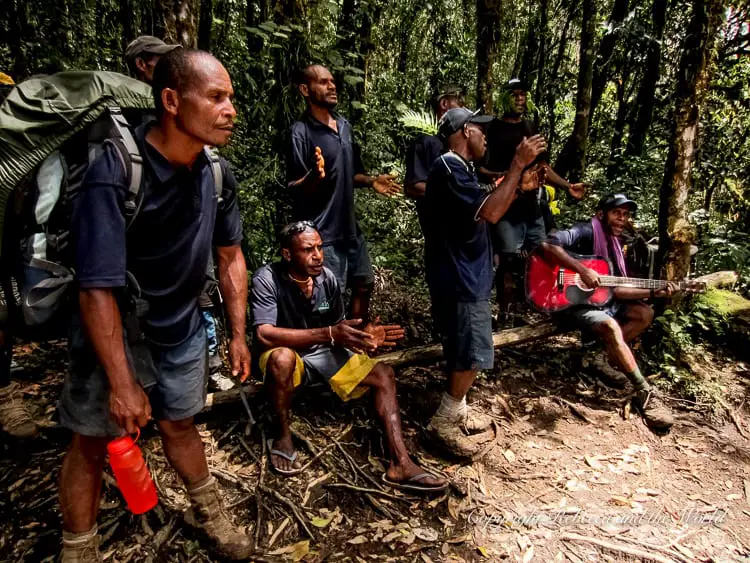
Our porters, or “the boys” as we now call them, begin with a roaring chant that pumps us all up – and draws jealous glances from the other group. There’s a healthy competitive spirit bubbling in our group.
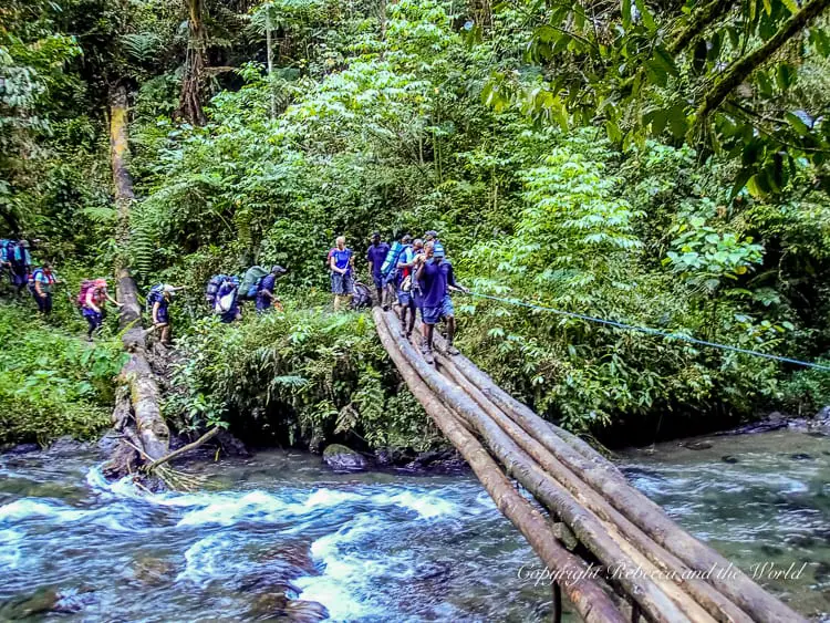
Later, we cross a creek by log, balancing precariously on the timber as one of the boys holds on to our bags behind us.
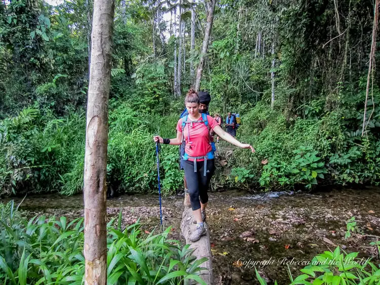
We leave Nauro camp and make the easy climb down to Brown River. This is our second river crossing of the trip, and we pull off our boots and socks and link arms with each other to stand strong against the current as we slowly cross.
We have an early lunch at Agulogo, a lovely village by a creek. As we eat, we nervously run our fingers over our maps. Ahead of us is the imposing-sounding “Wall”. Some say this is the hardest part of the entire track, and we pepper Wayne and the boys with questions about how long, how high, how hard. We soon find out.
READ NEXT: 9 mind-blowing Papua New Guinea festivals
Some parts of The Wall are incredibly steep and I find out quickly that you shouldn’t look down. There are several false peaks and lots of calls of “Is this the top?” only to be disappointed when it’s not. The boys keep us in good spirits, laughing and joking with us, and are always behind us when we need some help. They are invaluable.
These spots make it hard for us to believe that a war was actually fought here, and we question the sanity of far-away decision-makers giving orders in a terrain they did not know or understand.
We make it to our camp by midday and wander down to the creek, a gaggle of children in tow. The creek is home to a fast-rushing waterfall, and we take turns to hold ourselves under the freezing water, which pummels our aching shoulders and necks.
Later that evening before the sun goes down, we walk through the village and meet Samuel, the local pastor. He’s from Goroka but has been in Manari for a while. We talk together about Papua New Guinea, about the track, about religion, before we head back to our camp.
Over dinner, we listen to a podcast about Bert Kienzle, the “Architect of Kokoda” and learn more about the history of the Kokoda Track.
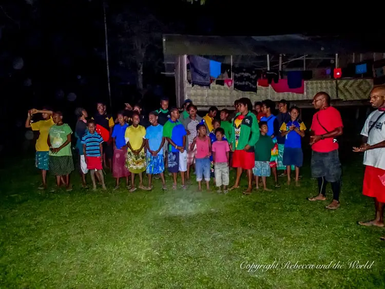
Our final evening’s entertainment is a group of kids from the village who sing songs for us before we all troop off to our tents for a good night’s sleep.
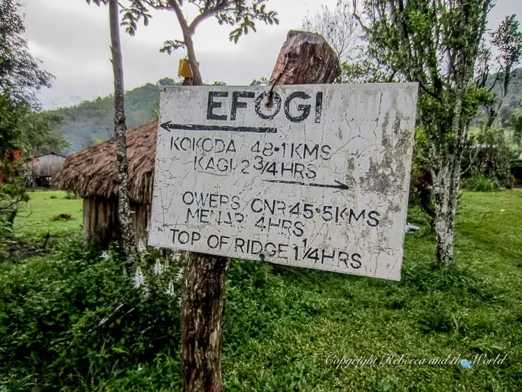
Day four: Manari to Efogi
It rained all through the night last night, and I wake worrying that the Kokoda Track is slippery. I haven’t fallen over yet and am trying to keep it that way.
Walking back down to the creek that we bathed in the day before, we cross over a log bridge. From here, it’s a really tough climb uphill, from 850 metres at Manari, to 1415 metres at Brigade Hill, and it feels like it will never end. We trudge on, my backpack becoming lighter as I suck down water and munch on snacks to keep me going.
Finally we reach Brigade Hill. Some of the boys greet us, cloaked in greenery from the surrounding trees, their faces blackened with charcoal, brandishing machetes as they lunge at us, yelling in a mock attack.
We walk up to the monument at the top of the hill. At the memorial, we sit as Wayne tells us what happened here decades ago, in the Battle for Brigade Hill. It’s a moving moment as we sit looking out over the hill, listening. We read two poems, “WX Unknown” and “For the fallen” and then sit in silence in our own thoughts.
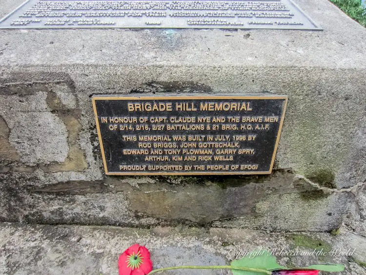
We gather back together as a group and continue down to what is thought to be Nishimura’s foxhole. Kokichi Nishimura was a Japanese soldier who fought in Papua New Guinea, and later returned to search for the bodies of his fallen comrades, spending years and millions of yen in the process.
As we move up to Mission Ridge, we have another steep climb. At times we are walking along a narrow ledge, with a sheer drop on our left. Stumbling here could be fatal.
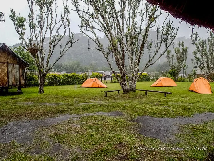
As we arrive at Efogi, our camp for the night, the skies open up, at first a trickle but then a downpour that leaves us soaked as we run for the cover of the camping hut. That night we thankfully all sleep in our tents under the shelter of the guesthouse, rain drumming down on the wooden roof.
READ NEXT: 20 Things to know before you visit Papua New Guinea
Day five: Efogi to Digger’s Camp
In the morning we rise to a damp village. We set off a little later than usual, and make our way down to Elome Creek. From here, it’s a steep climb up to Launumu. On the map of the Kokoda trek, it looks like a vertical climb.
Continuing down, we cross over Efogi River by a log bridge, gripping on to the rope that the boys have hastily slung up alongside the bridge.
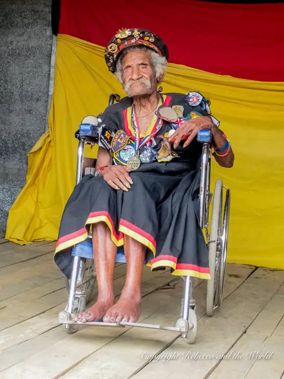
After a long walk that feels like we’re constantly going up, up, up, we arrive in Naduri. Here, we’re fortunate to meet one of the last surviving Fuzzy Wuzzy Angels, Ovuru Ndiki.
His son claims that Ndiki is 110 years old, and he sits in a wheelchair, proudly displaying the medals he has been awarded over the years. His hands are gnarled, and his eyes are milky-coloured.
Two weeks after we meet him, he sadly passes away, one of the last of the Papua New Guineans heroes who helped the Australians to win the Kokoda Battle.
We move on, with a long walk up to Track Junction. It’s a gentle climb but it’s sustained, and I feel my energy flagging as I work to put one foot in front of the other.
There are a few falls today, and even the sure-footed porters succumb to the path a few times, tripping over exposed roots and rocks. Despite this, the boys are all in a good mood, and every now and then whoops echo through the jungle.
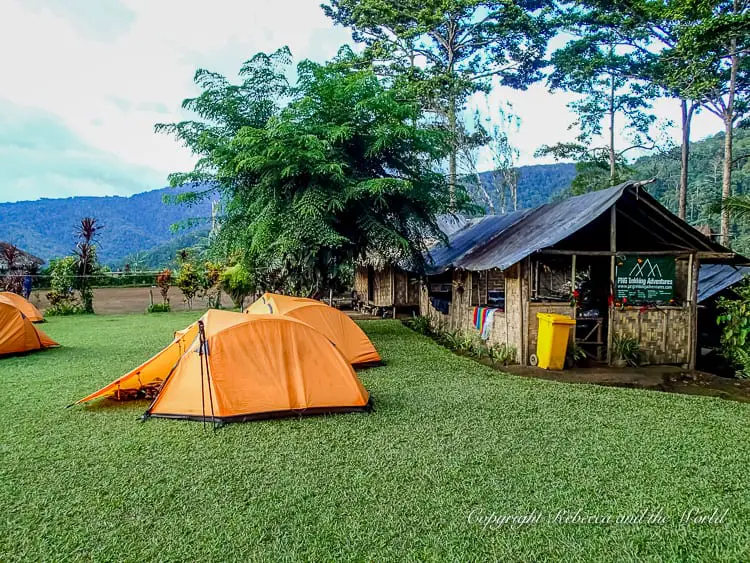
In the early afternoon we arrive at Diggers Camp, a camp that has been set up specifically for Kokoda trekkers. It’s a gorgeous spot, with pandanus trees looming over us, their roots exposed like long, lean legs.
We wash in the creek that runs by the camp, but all I can manage is to put my feet in the freezing waters, and even then my ankles and toes are numb after only a few minutes.
That night, we fall asleep to the sounds of the boys singing and playing guitar, the soundtrack of our jungle.
READ NEXT: 15 incredible things to do in Papua New Guinea
Day six: Digger’s Camp to Eora Creek
Today is our longest day on the Kokoda Track.
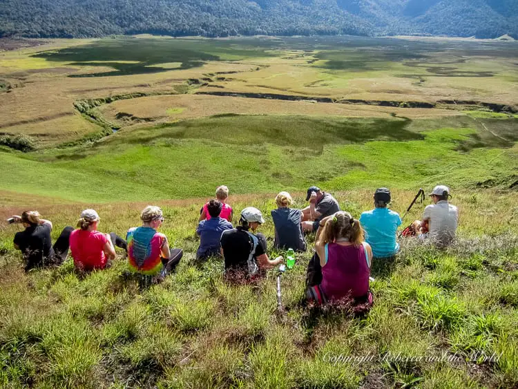
We leave camp at 6.30am, and walk to Myola Lakes, a side trip that many trekkers don’t take. We have the huge expanse to ourselves.
As we sit on the hillside, looking over the dry lake bed, Wayne tells us that the area was used as a dumping ground for food and supply drops for the Australian troops. It took them a while to figure out how to do this properly. For many months they lost around half of all the goods because they were dropping them from too high.
The area is considered tambu, or taboo, to local people as it’s unknown how the lakes were formed and why they are now dry.
We continue on, heading back to the main Kokoda Track via the Moss Forest. The path here is at times invisible, and it feels like we are cutting our way through and forging a new pathway.
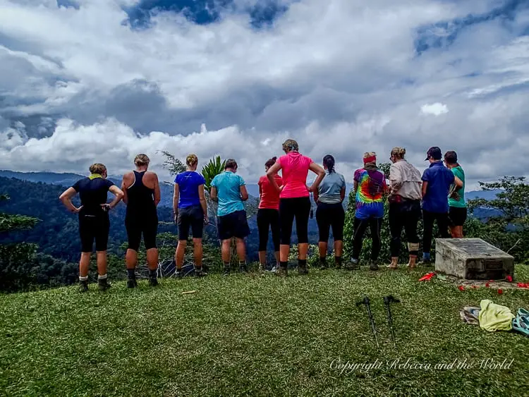
We climb to the highest peak on the track, Mount Bellamy, at 2,231 metres high. A little further on we reach The Gap Lookout, and we can see through the Kokoda Gap, envisioning our end point beyond the mountains that lay before us.
After morning tea, we climb a small hill and through the trees we can hear the boys singing. They’ve set up an impromptu concert and we sing together, including a rousing version of “Old Macdonald had a farm”. Rejuvenated, we kick on and stop for lunch at Templeton’s 2 Crossing.
As we eat, the sky ominously turns dark and clouds quickly roll in. It’s not long before a few drops fall from the sky and we move inside to finish eating. By the time we’ve finished our lunch, the rain is coming down hard, and the hut is surround by a wall of water rushing from the eaves.
We know we can’t stay here – who knows how long the rain will last? Donning hats to keep the water off our faces, we rush out into the rain.
We move faster than we have before. Surprisingly, the rain makes it easier to see where we are going, as it washes the mud off the rocks and roots. Our boots and socks are soaked and mud is splashed up our legs. Throughout it all, I keep reminding myself that the Diggers endured this weather day after day, with little shelter and no fire at night to dry themselves out.
Finally the rain subsides, but it leaves behind muddy paths that we slosh our way through.
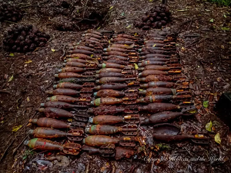
We take a short path off the track to see piles and piles of mortars and grenades that were discovered only a few months ago. I ask whether they have been checked and detonated yet, given they were only so recently found, and quickly head back to the path when the answer is no.
That night, we dig trenches around our tents to keep the water out. We camp at Eora Creek which has swelled with the day’s rain. The rain doesn’t stop throughout the night, and it’s accompanied by an amazing storm that lights up the sky, thunder cracking and rumbling as we eat dinner by candle light.
Day seven: Eora Creek to Isurava Memorial
After the heavy rain and thunderstorm, the night’s sleep was accompanied by the sound of the creek water rushing by, and it was more than once that I woke with a start, dreaming about flash floods.
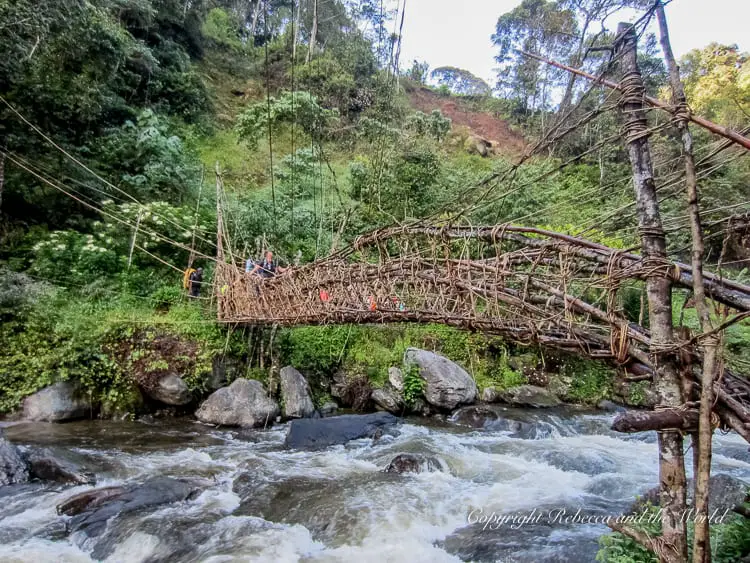
In the morning, the creek is calmer, and we cross it via PNG’s version of the Sydney Harbour Bridge. On the other side of the creek we talk about the fighting that took place here, a tough place for the Australians to defend.
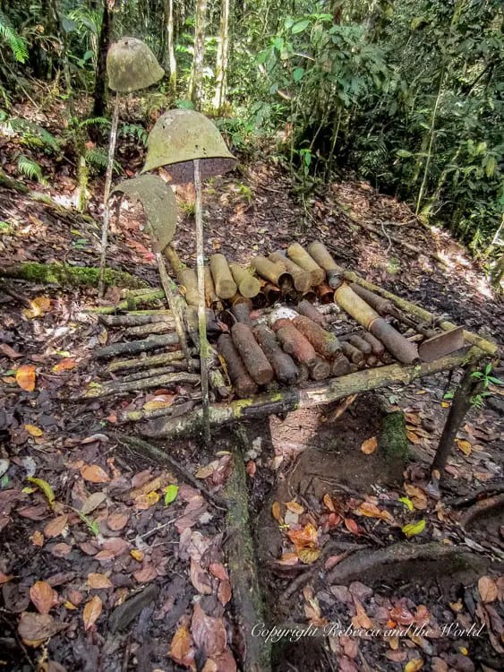
Up the hill, we see a stash of the remnants of Australian and Japanese ammunition. We look through the trees where a Japanese mountain gun was placed, with a perfect view straight down to Eora Creek.
We are blessed with gorgeous views from Alolo village, our morning tea stop. After our snacks, we continue on with a fairly easy walk to Surgeon’s Rock.
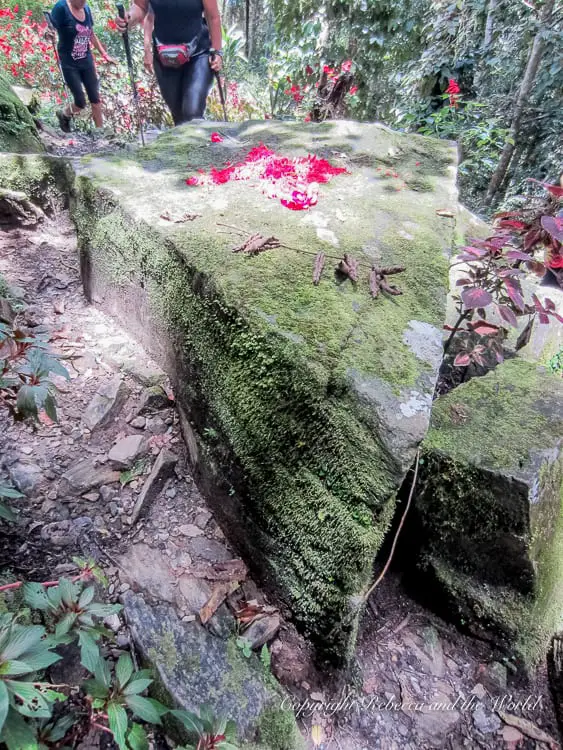
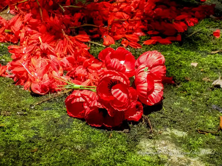
Now covered in moss and decorated with flowers and poppies left by other trekkers, it’s hard to imagine doctors working here.
Surgeon’s Rock was the place where people with significant injuries were sent, and many amputations were performed here. From the rock, people had to make their own way to the field hospital at Eora Creek, several kilometres away.
Wayne describes men crawling back along the path, some still with severe wounds, others with freshly removed limbs. Many succumbed to the pain, collapsing alongside the path, dying with their faces in the mud.
As we sit in silence, all we can hear is the twitter of birds, a far cry from the screams and moans that would have echoed around this area in 1942.
We continue on to Isurava Memorial, our camp for the night. We wander around the beautiful memorial, lost in our own thoughts. There are four granite pillars, each with a single word inscribed: courage, mateship, endurance and sacrifice.
These four words sum up the values and spirit of the Australian fighters.
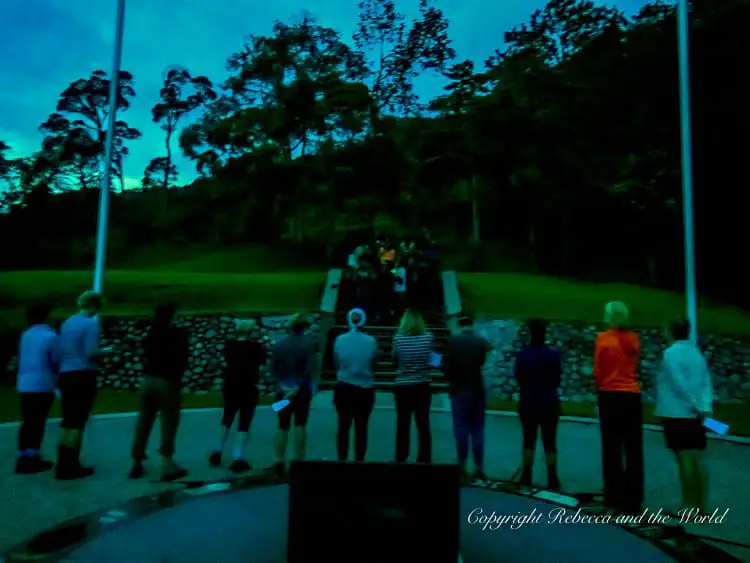
Day eight: Isurava Memorial to Kovelo
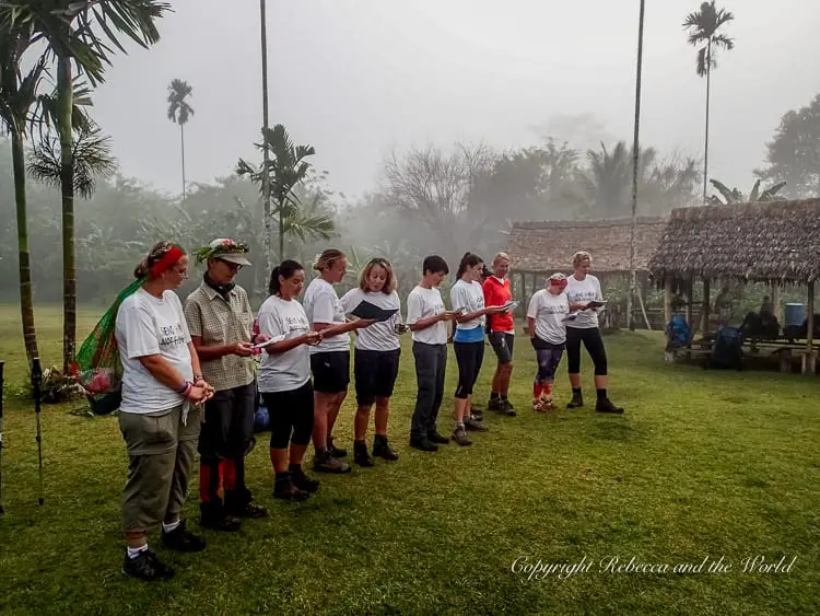
We wake up early in the morning for a dawn service at Isurava Memorial. In the slowly lightening sky, we read poems and sing the Australian and Papua New Guinean national anthems. It’s a surreal moment, standing together in the dawn light and thinking about what the track means to each of us.
Back on the trail, we are getting closer to the end. We begin to go downhill, and my knees are in agony, every step bringing pain. I grit my teeth and continue on as we walk to Deniki. The group has spread out over the track, and we re-group at Hoi, beside a beautiful creek.
Thankfully, the rest of the way to Kovelo is fairly flat. Before we continue the walk, the boys appear with leaves and flowers woven into crowns, and proceed to decorate us.
We walk as a group, in high spirits, the flat ground a welcome respite after the downhill track. My knees are just about to thank me before I stumble and slam my right knee into the ground – my first fall on the track.
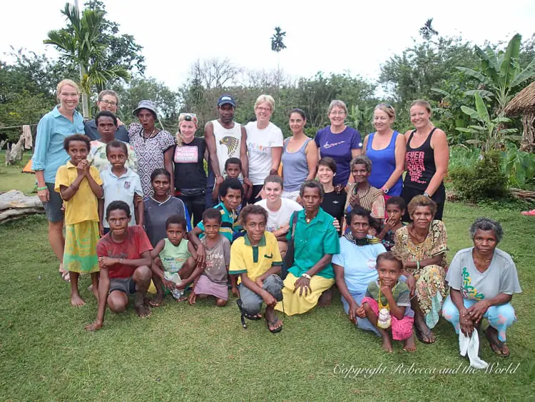
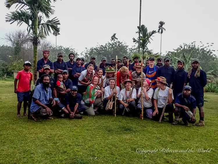
That night, many of the boys’ families come to join us at our camp at Kovelo, and we are surrounded by wives and children who have walked here to meet us. It’s a special time as we get to meet the families of the men who have helped us through this journey, and who we feel we now know so well.
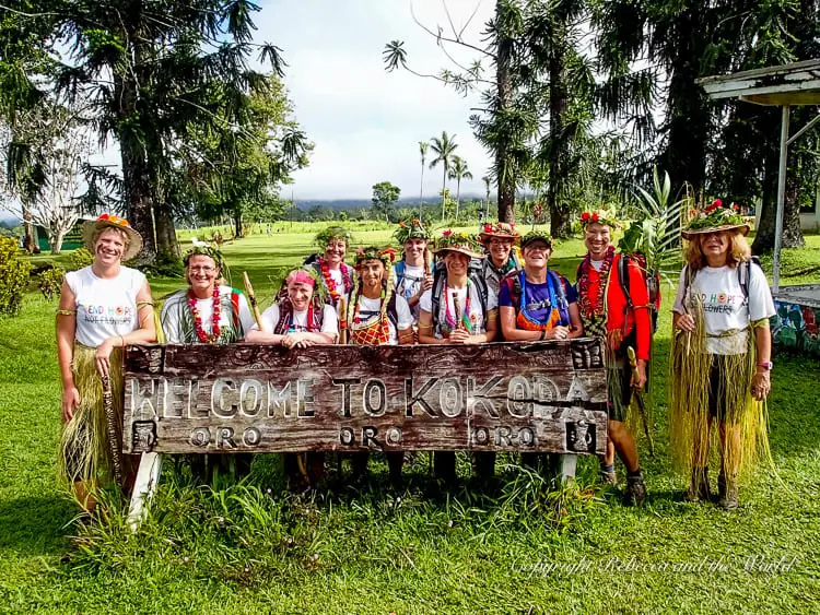
Day nine: Kovelo to Kokoda – and home
Our last day. It’s a bittersweet moment – mixed feelings of accomplishment and yet sadness at something being over.
We have a lazy start to the day – Kovelo is only 20 minutes’ walk from Kokoda – but before we leave we are decorated again. The boys’ families have brought us grass skirts, and we are adorned with more flowers and leaves before we have a small ceremony.
One of our group reads a poem, and then we all sing a song that we have written. The boys give us gifts. Wilford, my porter, hands me a tapa cloth bag and carved pole. There are many tears.
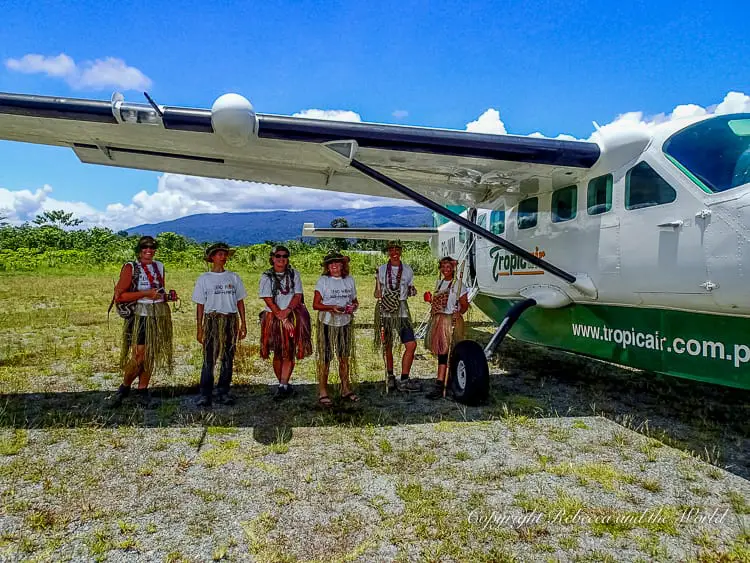
As a group, we all march toward Kokoda. Our group has grown with the addition of the boys’ families. We stop for photos at the archway that signifies the end of the track, in disbelief that it’s all over.
As we walk through Kokoda town, people stop and yell “oro, oro” to us, impressed by our beautiful bilas.
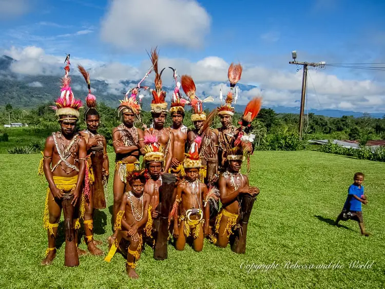
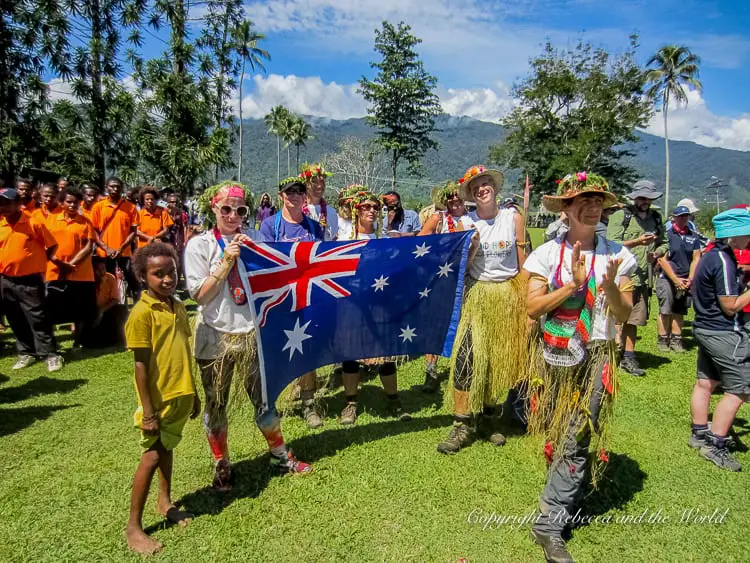
Today is Kokoda Day, recognising the Fuzzy Wuzzy Angels and the Kokoda Track itself. The various village groups sing and dance, sweeping us up in the festivities. We are part of the procession to the main stage area. We watch the solemn raising of the Australian, Papua New Guinean and Oro Province flags.
Later, when the official ceremony is over, we walk as a group to the airport. The kids beg to carry our backpacks, some of which are almost as big as them.
We board our plane to return to Port Moresby. As we fly over the hills we look down and see from above what we’ve walked through. From high above, we can’t see the track, but we see the mountains we’ve walked over and around.
We’ve done it. We’ve trekked the Kokoda Track.
Did you find this article helpful? Consider buying me a coffee as a way to say thanks!
Have you walked the Kokoda Track? What was it like for you? Share your stories in the comments below.
Related posts
- 15 incredible things to do in PNG
- What to know before you visit PNG
- 9 epic Papua New Guinea festivals
- The ultimate Kokoda Track packing list
PAPUA NEW GUINEA TRIP ESSENTIALS
- Book your flight to PNG online with Skyscanner. I like how this site allows you to find the cheapest days.
- One thing I always purchase is travel insurance! Travel Insurance Master allows you to compare across multiple policy providers, while SafetyWing is great for long-term travellers and digital nomads.
- Wise is my choice for sending and receiving money and spending money overseas (you can get a digital and physical card).
- Find great hotels across PNG. Check prices on Booking.com and Expedia online.
- Grab an e-sim to stay connected while on the road.
- Check out my Amazon shop for my fave travel items – everything from backpacks and suitcases to travel adapters and beauty products.
PIN IT FOR LATER:


The blog article on what to expect when trekking the Kokoda Track, featured on Rebecca and the World, serves as a comprehensive and practical guide for prospective trekkers. Drawing from my own experience in undertaking challenging treks, I appreciate the author’s detailed insights into the physical demands, cultural experiences, and emotional aspects of the Kokoda Track expedition. The article skillfully covers the nuances of the trek, offering valuable tips on preparation, gear, and the unique cultural encounters along the way. The personal anecdotes and reflections shared throughout the post add a relatable dimension, making it an invaluable resource for anyone considering the Kokoda Track as their next adventure.
Hi Rebecca,
Which company did you use to hike the Kokoda Trail?
Thanks
Hi Emma! I did the trek with PNG Trekking Adventures. I’ve got another blog post which covers what to pack etc as well as how to choose a trekking company (https://www.rebeccaandtheworld.com/kokoda-packing-list-tips/). Let me know if you have any more Qs!
Hi hamamas no gut tru long lukim dispela! Papua New Guinea emi namba wan ples bilong mi. Mi bin istap long dispela hap twopela yia. Mi tinkim long yu na olgeta wantok bilong yu. Yu mas kumap hamamas!
Hi Rebecca,
It’s Naomi from PNG Tourism again, how are you? Loved your last post and thought you might be interested to know that we’ve just done the soft launch of the website Do Kokoda and it would be fantastic if you could be one of the first to upload your testimonial of your trek to the site.
Check it out – we’re getting celebs and normal consumers to upload their stories to create a hub of helpful info about Kokoda for Aussies looking to visit.
Check it out and let me know if you have any questions.
Cheers
Naomi
Good to hear from you! I’ve just submitted a testimonial – but had issues uploading some photos. Will send you an email. 🙂